We’re never too old to learn, and this morning I learned a new (to me) weather term:
A derecho is a widespread, long-lived, straight-line wind storm that is associated with a fast-moving group of severe thunderstorms known as a mesoscale convective system. Derechos cause hurricane-force winds, heavy rains, and flash floods.
Roht Roh (Scooby Doo voice).
Should we be concerned? You betcha!

Unlike cruising in the Eastern Caribbean, here in the Bahamas quickly approaching weather fronts create chaotic wind, coming from almost any direction. Frequently lines of unsettled weather rolls east from Florida. Watch out!
Which direction is the strongest wind, so we can find appropriate shelter? Several weather prediction models are shown above, and while just a few days away, they indicate radically opposite wind directions and velocities. Which prediction model is correct? With all our advanced technology we still can’t know that answer!
Until now, our winter pattern of strong easterly trade winds was shared with the Eastern Caribbean (the Windward Islands), for an extended period of time this year, down here in the Jumentos and Raggeds. Until now, storms rolling off the coast of Florida have stayed north, and so we could relax.
But as our friend Bill of Kaloonamoo has stated: The Wind Man Cometh. And oh boy, is he furious!
A brief excerpt from weather guru Chris Parker’s forecast:
Southern Central Bahamas:
Peak impacts are forecast for Tuesday afternoon.
Winds will be similar (sustained around 20–30 knots with gusts of 30–40 knots) and squall activity (with some cells potentially reaching 40–50 knots) may linger into the early evening.
Strongest wind veers from SE to SW late Mon24 night as the1st band passes, and veers from SW to NW Tue25 afternoon, as the 2nd band passes.
So after enjoying a lovely monthlong stable easterly breeze, we lowly vessels cruising the southern Bahamas are getting a reality check. Perhaps getting too fat and happy with steady 20 knots from the east. Every day is (was) beautiful – sunny and mild in the low 80’s. Sure, wind was brisk, but predictable.
Now most boats are accepting the predicament and planning to move. But to where? Very few anchorages here offer protection from the west. To ensure full protection, we need to move far away, at least a day or two.
An informal consensus of vessels seems to be heading north, back up toward the Exumas, mainly Georgetown, being the closest pseudo safe port. Some more stubborn or in denial, are just tucking into tight spaces, risking collision or dragging as the wind clocks around. As typical, Fayaway is choosing the route less traveled. We’re heading northeast, across deep water to Clarencetown, Long Island. Clarencetown has a good and spacious harbor with access to provisions, and is more protected.
So, off we went, expecting to thread the proverbial needle between adverse easterly wind, and arriving in Clarencetown before getting smacked by the Derecho.
How’d that work out? You might ask?
Bob and Lynda aboard Tiger Lily (#tigerlily) and Fayaway departed from Ragged Island at 1400, headed south initially into light 12kt southeast wind and mild chop. Once around the southern tip, I set our wind tracking autopilot to hold a course at a comfortable 60 degrees off the wind. The sleeping racer in me awoke, to fiddle with that angle, frequently adjusting for lifts and drops in wind speed, and to deal with changing wave chop.
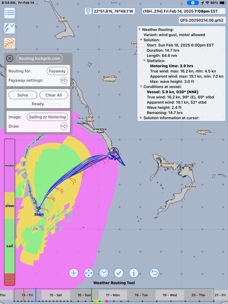
As the afternoon progressed we sailed a lovely course to about 30 degrees more north than our rum line, expecting the freshening wind to veer more southerly. (See above routing).

At around 2200 we did veer, but unexpectedly the wind more than freshened! Brisk is probably a more accurate description! By the time we reached 10 nm west of South Point, Long Island, we were rolling in 2 meter waves breaking athwartship, spraying into the cockpit with a steady 25kts and still increasing.
Kelly, having prior dosed herself with Dramamine, decided she’d just stay below. However, she did assist me with pulling in a third reef. We deeply reefed, not for wind, but for keeping our speed down. Our departure time anticipated an arrival after sunrise, conservatively expecting to maintain 5-6kts. But we’d be cranking 7+kts for several hours. If we didn’t slow down we’d be arriving outside a bommie-strewn harbor entrance in darkness.
Apparently, the cold front was dipping south earlier and faster, with wind being sucked into during its approach.

As we rounded up changing to a more northerly course along the eastern shore of Long Island, the wind maintained its strength and eventually began clocking a bit to the southwest. The miles clicked off more quickly. Lightning appeared to the west, and as it seemed to be getting closer I turned on the radar. Sure enough, a broad band of squalls was heading our way! Roh roh!
Having been in this situation before there are many factors to consider. Pitch black, boat on a north heading, and squalls are approaching from the west. Going too fast, 25 knots astern, plenty of sea room. Time to take action: Furl the genoa, drop the main, and motor more slowly. Next: Hold course? Now comes another decision point. Are we moving slowly enough to let the squall, which appears to be on a perpendicular course, get ahead of us? Maybe the lightning isn’t so bad? Looks to be approaching rather quickly. Is it moving fast enough? So we stop and wait? Or turn 90 degrees? Our color Doppler radar offers colors to signify intensity and general direction.
In my experience, trying to dodge a fast approaching squall, often doesn't help. I decided to just get on with it and plunge right into the mouth of the beast.
WHITE OUT!! Crack! Boom! Flash! Lightning strikes closer! Rock and roll, with the following seas and steady droning of the motor.

I just increased engine speed a bit to hold a steadier coarse. I’m squinting forward into the spray, gripping the wheel tightly, while making careful note of the compass and our proximity to shore about a mile away. Sideways piercing rain and 25 knots from every direction. Seems to last for an hour. In reality it tapered off after a thirty minutes, which seemed not to pass quickly enough!
As my vision cleared, I noticed that a boat on AIS, located about five miles behind, had taken the turn 90 degrees attempting to avoid approach. But since the squall was such a massive band, he not only did not avoid it, he ended up adding several miles to his intended destination.
Frequently needing to wipe my eyes off, the heavy mix of cold salty spray soaked into my foulies.
We arrived at the entrance to Clarencetown, just as the rain tapered, few miles behind Tiger Lily.

Oh, the fun of cruising! Fortunately, these adverse memories fade so quickly, being easily shadowed by the overwhelming joys.
We hope you enjoy your days!
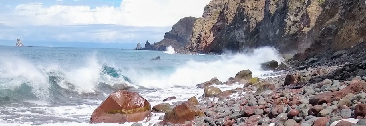
A few scenes before leaving Ragged Island:


Not a new term to me. I’ve had to repair two Switch Rooms that had their roofs torn off by derecho. The first, and worst, in Cedar Rapids, IA; the second, Salina, KS. You’ve become quite the Chat GPT artist! 😀
LikeLiked by 1 person
great blog. The Bahamas are great, the weather sometimes not so much!
LikeLiked by 1 person
Was I hacked this is gaitweigh@aol.com who is exuberant8ddcca?
LikeLike
I think it’s a WordPress username that was automatically assigned. Not a hack.
Chris
LikeLike
I love Clarencetown. Enjoy!
LikeLiked by 1 person
Well Chris it’s always an adventure. Curious what size is Tiger Lilly? Did I downsize too much with my Seasprite 34?
LikeLiked by 1 person
Tiger Lily is a much larger, heavier HalbergRassy 45. Your boat has advantages of being able to maneuver more easily. So you could have more easily ducked into a tighter area and stayed in the Raggeds!
LikeLike