
Sint Eustatius, referred to in my previous “diving” post as Statia (pronounced Stay shah) is a small island located in the northern Leeward Islands between Saint Kitts and Saba. There’s a rich history here, especially with the early beginnings of the United States. I don’t recall learning this in my high school history class, but Statia claims responsibility for the US defeating the British during its 18th century revolutionary war.

More on Statia’s history in a few. But first a quick tidbit about our departure from Sint Maarten, which is always a cattle-stampede-like affair.
Like the soapy remnants after a plug lifted from the kitchen sink drain, the famous draw bridge released Fayaway amongst a dozen other vessels to be dispersed out into the Caribbean Sea.
Fayaway’s previous visit to Dutch Sint Maarten was shortly after the Simpson Bay bridge had been hit in 2019. (See above link for video). Coincidentally, the again-rebuilt control booth was hit again (while we were anchored nearby) this year. This “super-yacht-hits-bridge” event has become an afternoon ritual for folks imbibing at the adjacent Simpson Bay Yacht Club. Beer in one hand, cellphone in the other, waiting for some action!

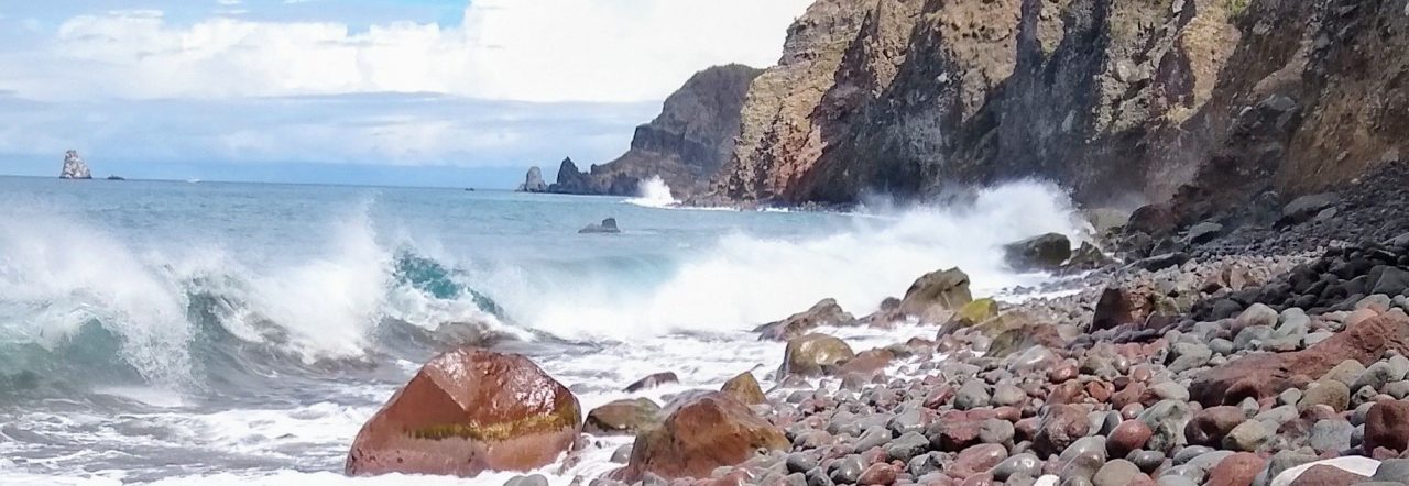
As we approached our new target, Statia, gray wisps of inconsistent dark clouds emanated westward-sweeping curtains of watery pellets onto ancient volcanic domes. While mildly disappointed about missing a convenient fresh-water rinse, we were just as pleased with the cloudy plumes arriving ahead of us, as we’d rather approach an unfamiliar anchorage without a blinding squall. Statia and its volcanic cousin St. Kitts (Saint Christopher) looms in its backdrop not far to the Southeast.

AIS instrumentation beeped repeatedly, warning of several vessels listed as tugs, cargo ships and tankers. The ominous ships and tankers were listed as 150 meters or more in length. Yikes. We’ll take a wider and unquestionably safer approach! After spending a few more minutes staring at the chart, clicking on each AIS icon, it became clear that these behemoths were stationary at anchor, and wouldn’t interfere with our approach.
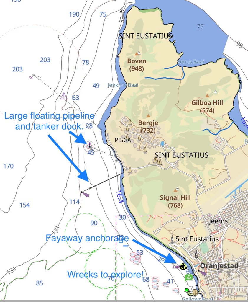
Our Doyle guidebook notes that Statia is home to a large bulk fuel storage facility. Hence explaining the large tank farm ashore, tankers and offshore piping facilities that we passed at a safe distance. This site explains how they handle more than 90 million barrels per year.
Netherlands Antilles consists of five islands divided geographically into the Leeward Islands (northern) group with the islands of Saba, Sint Eustatius, and Sint Maarten and the Windward Islands (southern) group with the islands of Bonaire and Curaçao. Their government is Parliamentary; it's an autonomous country within the Kingdom of the Netherlands; full autonomy in internal and partly in foreign affairs. Note: each island has its own government.

Back to the historical implication from our opening paragraph: Statia’s rich history associated with United States heritage, as well as a darker past associated with slavery, is worthy of learning. Sadly, many Caribbean islands share a similar history of human trafficking and exploitation. While sometimes not pleasant to learn of how cruel we humans can be, our history is important never to ignore.
Archeological digs finding telltale pottery and skeletal remains indicate that Venezuelan Saladoid Indians are the earliest settlers at Golden Rock, arriving sometime in the 5th century.

Golden Rock? You might ask? Read on!
Fast forward to the 17th and 18th centuries, during which time an active European colonization cycled through the Caribbean. Of course, the earliest explorers (conquerors) quickly exploited and wiped out any later Arowak and Caribe residents with guns and disease. Then came the next phase…
War between the European powers usually had its repercussions in the Caribbean. When the Dutch were involved, the consequences for St. Eustatius were foreign occupation, often utilizing plunder and destruction. Between 1665 and 1713 the island was conquered no less than eight times by English and French troops. Between 1781 and 1816, St. Eustatius went through another five occupations!
During the mid and late part of the 1700’s Statia was THE trading capital of the Indies, when it was not uncommon for 300 ships to lie at anchor. Massive quantities of various goods from all over the world (sadly, as well as slaves) were found here, which also made it to be a prime target for plundering, especially by the British, who were simultaneously fighting the new American rebels up north.
Much like Switzerland, the Dutch at this point remained independent and would deal with anybody. They provided needed arms to support the American Revolutionary efforts, with St. Eustatius being the first to officially recognize sovereignty of America. Statia’s merchants became so wealthy from their trading centricity, that the island became known as The Golden Rock.
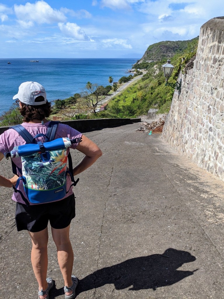
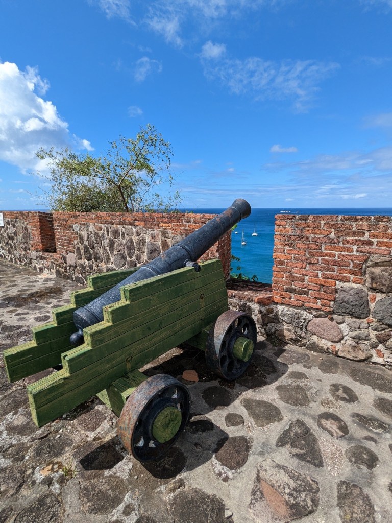
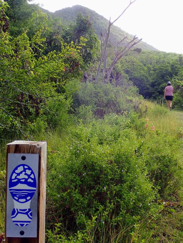
So what about The Quill? Oh, and that too! Not really too much to say there except that The Quill is the dormant 4,000 year old volcano caldera that we hiked up before going diving. (See first picture). Aside from the fantastic views, we enjoyed viewing the flora and fauna.
We remain fascinated by countless hermit crabs found so far up the hill, sometimes on trees. Prodding along with their long antennae, one might say, “the place is littered with them!”. Easily startled by our walking, they snap into their shells so quickly, lose footing and roll down and across the trail, making themselves very obvious. I doubt we’d even notice most if they’d just not move! Making a chirping sound if you pick one up, we saw varying sizes from one half inch to four inches long. Hermit crabs live in vacant seashells, that they continually exchange (upsize) as they grow. We found them more than a mile from any shoreline. So where do they get the shells? Do they walk back to the beach? Fight each other? It’s a long way for these little vagabonds to walk every time they want to “move”!


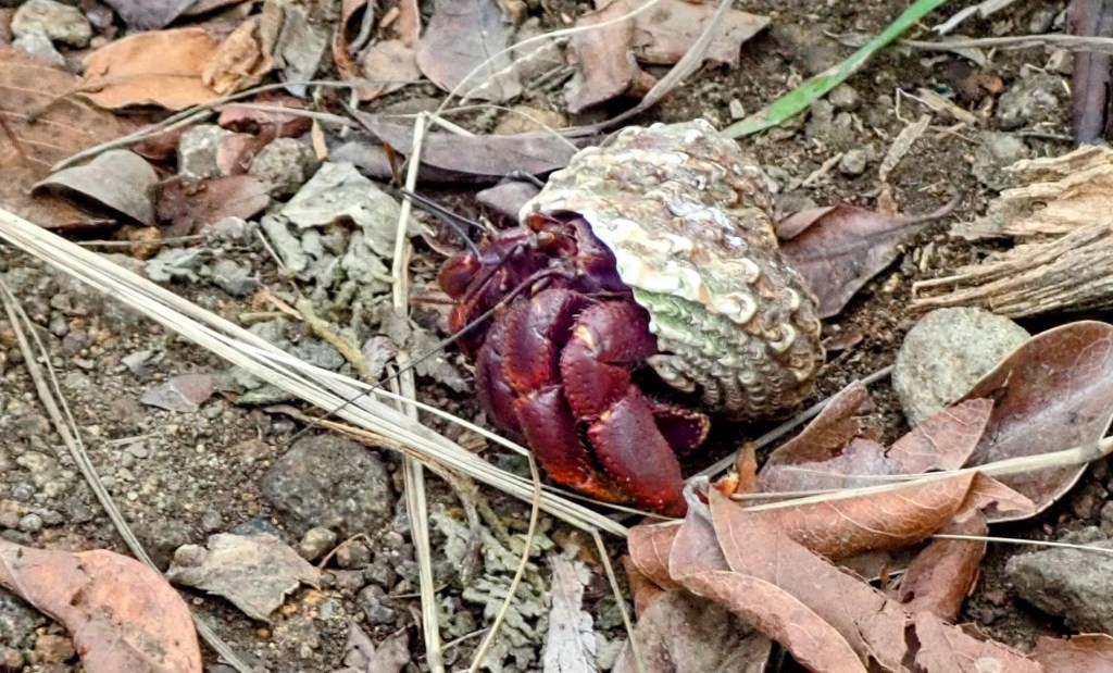


While it’s correct that hermit crabs reuse the shells of other critters like sea snails, they don’t necessarily wait for them to die first. Hermit crabs have been known to kill snails if they have their eyes set on their particular shell, or even oust other hermit crabs to take their property. It’s not always violent, though. Sometimes hermit crabs will form a chain, from smallest to largest, while they size up a vacant shell. When one of them fits, that crab jumps into the new shell and all subsequent crabs swap up to the next shell in line. Fun!
Source: https://www.quora.com/Where-do-hermit-crabs-get-their-shells-How-are-the-shells-formed-in-nature
Historical references: Doyle Cruising Guide; Admiral Rodney House and Museum.

Informative post, as always Chris.
LikeLike
Thanks for sharing this.
LikeLiked by 1 person